Land Cover Classification
|
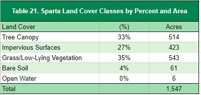
Sparta’s tree canopy is estimated at 33% (Table 21), which compares favorably to the reference Michigan communities. Impervious surfaces (buildings and roads) make up 27% of the land cover. Grass and low-lying vegetation comprises 35% of the community. The Village's borders have the greatest canopy cover, while the major neighborhoods and commercial areas have the greatest amount of impervious surfaces (Figure 16).
|
|
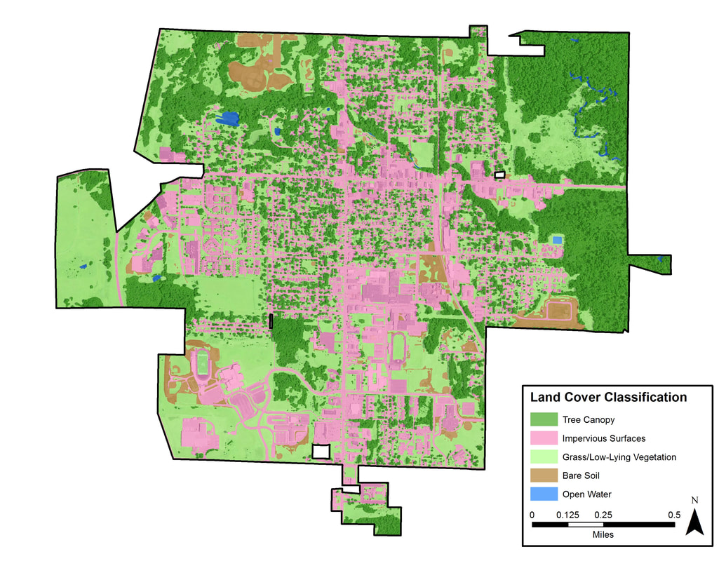
Figure 16. Sparta land cover classification.
To view this and other maps in an interactive format visit the Story Map
Tree Canopy Related to Land Use
Tree canopy levels tend to correlate with land use types. Figure 17 illustrates a land use map of Sparta. Table 21 presents land uses as they relate to land cover types detailed in the previous section.
In a typical community, commercial areas tend to have lower levels of tree canopy and higher levels of impervious surfaces than residential districts. This is true in Sparta, where the commercial areas have 17% tree canopy and 53% impervious surfaces; while residential areas have 33% tree canopy and 30% impervious surfaces. The agriculture/forested lands in Sparta have the highest level of tree canopy, 75% and lowest level of impervious surface 1%; and institutional lands have the lowest canopy cover at 9%.
Opportunities should be pursued to increase canopy cover in commercial areas and institutional lands due to low canopy cover and high amounts of impervious surface. These two factors may indicate that these land uses have a significant impact on the quantity and quality of the community’s stormwater runoff.
The open space/recreational land use, contains the highest percentage of grass and low-lying vegetation (63%) and bare soil (18%), which provides opportunities to increase canopy cover in this land use. In addition, low-lying vegetation makes up at least 23% of the land cover across the city's other land use types, providing additional opportunities for tree planting and increasing canopy cover. For example, the residential land use’s moderate canopy (33%), moderate level of impervious surfaces (30%), and higher percentage of grass and low-lying vegetation (35%) indicates there is room for canopy expansion in this land use. Providing public outreach on the benefits of tree canopy specifically related to quality of life benefits (e.g. increased property values, health improvements, social benefits) could make this an ideal land use to pursue for canopy expansion. Since this is Sparta’s largest land use, any expansion efforts should try to involve residents.
Overall, these results indicate that there are planting opportunities across land use classes, however these might be limited in some cases by impervious surfaces.
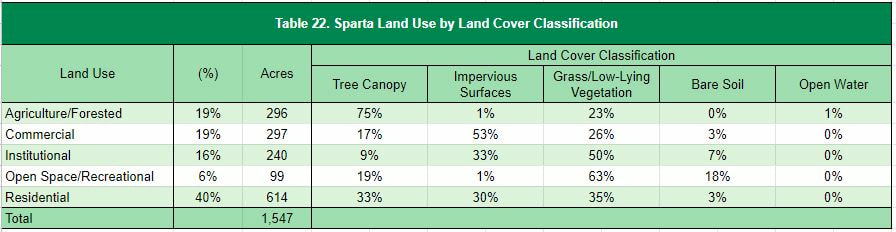
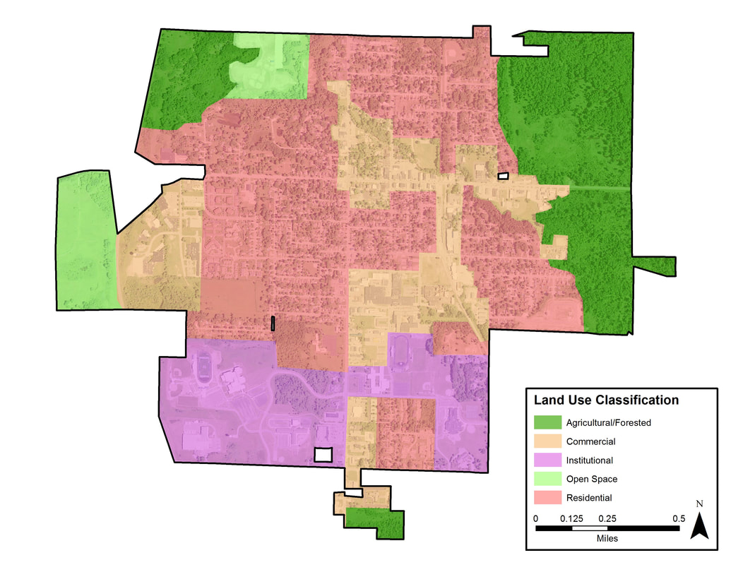
Figure 17. Sparta land use classification
Priority Planting Areas
|
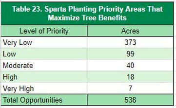
The planting priority levels map (Figure 18) can be used to focus in on the locations in which plantings may deliver the highest impacts in terms of ecosystem benefits and overall benefits to the community. Sparta can use this as a guideline for deciding where future trees can be planted to have the greatest impact on benefits and stormwater runoff. Of the 538 plantable acres, 12% of those acres (65 acres) are listed as moderate or above planting priority. If only these areas are planted, Sparta’s canopy would increase from 514 acres to 579 acres, increasing the total canopy cover to 37%.
|
|
In many cases the lower levels of priority can be attributed to the land use type. In Sparta’s case this is due in part to the location and levels of agricultural and forested land. More information on the inputs for the planting analysis can be found on the Project Overview.
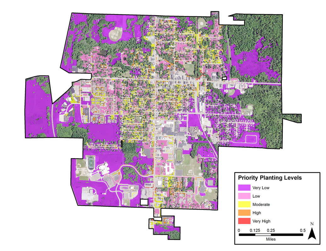
Figure 4. Ferrysburg prioritized planting areas.
Tree canopy percent by census block analysis found below can be used as a supplemental tool to determine which neighborhoods are in most need of planting (Figure 19). For Sparta, the tree canopy percent analysis largely confirms the results of the planting priority analysis, which shows small pocketed areas of Moderate and higher planting priorities dotted throughout the central residential and commercial areas. The northside of the village accounts for much of the existing canopy (agriculture/forested land use) and therefore falls into lower planting priority levels.
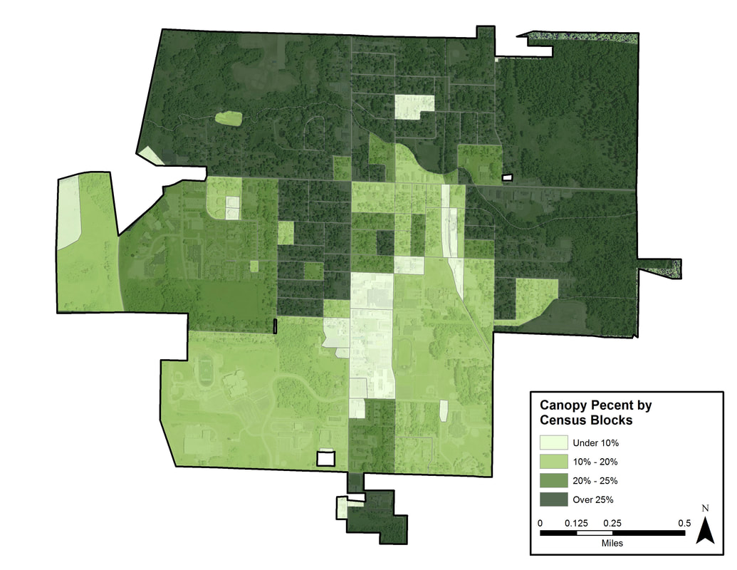
Figure 5. Ferrysburg tree canopy by census block.
Ecosystem Benefits Analysis
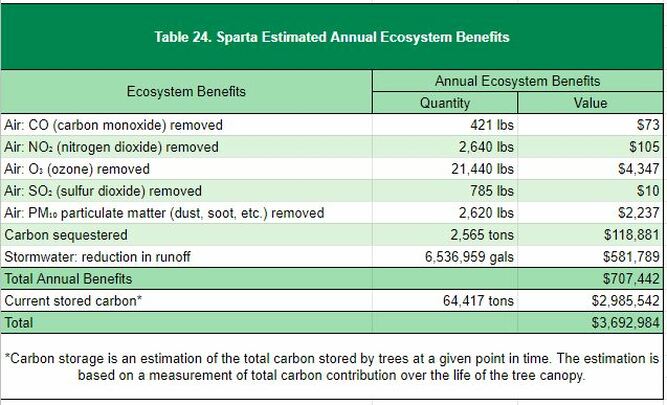
Community forests are important components of the ecosystem and provide quantifiable benefits. Sparta realizes an annual benefit of $707,442 for reductions in air pollution, stormwater reduction, and carbon sequestration from the tree canopy. The village also benefits from carbon stored in the trees, which contributes $2,985,542 over their lifetime.
Custom Analysis: Canopy Change Analysis
|
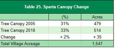
NAIP imagery from 2005 and 2018 was analyzed using Remote Sensing capabilities to track the historical canopy changes within census blocks in the Village. The results from this analysis show that in the 13 year period, Sparta has gained 2% canopy overall (Table 24). Figure 20 shows how the canopy has changed in the city. In general, the canopy appears to have expanded across the Village with the largest consolidated gains located in the edges or forested areas.
|
|
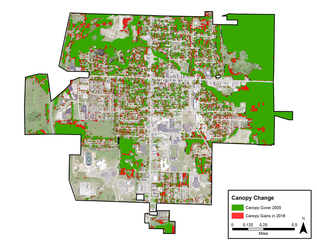
Figure 20. Creekside Park tree placement analysis.
